Trip Overview
Kayak Trip Report
McGrits Creek/Ortega River
Jacksonville, Florida
June 17, 2017
From the paddle advertisement on the Florida Sea Kayak Association FSKA site, “Before the FPTA changed their web site they had a paddle trails section that worked for local paddles. They listed a paddle in the McGirts Creek Park. That turned out to be a tree choked little, very little, stream. So I vowed to do a trip and post the real McGirts creek paddle. The difference between Ortega and McGirts depends upon which map, person and chart you look at. We could go to where McGrits Creek is labeled, but that would be too easy.” This was a double paddle with some attending from Seminole Canoe and Kayak Club and some from FSKA.
So in the process of advertising for the paddle of the lower Ortega up to the part where we couldn’t go any farther I find John J. Or perhaps more accurately John J. finds me. It seems that John is paddling the McGirts Creek from the Baldwin Trail to the mouth of the Ortega River in segments. One of the typical goals of kayakers in Florida is to paddle a river from headwaters to end. Most pick the bigger rivers, St Johns 310 miles, Suwannee 241 miles, etc. John has picked the McGrits Creek/Ortega River. He has broken it up into eight segments. The first segments he finished were the Baldwin Trail to Beaver Street (Hwy 90) 2+/- miles, and Beaver Street to Chaffee Road. Next segment is Chaffee Road to Normandy. He interprets these sections as navigable. My thoughts on the same water are navigable? Not so much. But it is his quest.
...
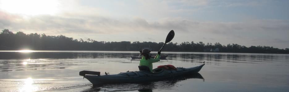
Our paddle started at the Wayne B Stephens boat ramp at the end of Ortega Farms road on Fishing Creek. http://www.coj.net/departments/parks-and-recreation/recreation-and-community-programming/waterways-and-boating/boat-ramps/5---wayne-b--stevens.aspx To beat the heat the four of us started at 7am. A short paddle and we were in the Ortega River. Maybe a ¼ mile wide at this point the river is lined with houses, boat docks and small islands. The river narrows slightly as we pass under the Timiquana Bridge headed up stream, south. This part of the river has houses on the west shore and a preserve on the east side. Gators live on the east side along with a variety of other animals and birds. There is an eagle nest over there somewhere. This part of the river is also the part many of the locals use for water skiing. The episcopal high school often comes to this part of the river to hold crew races. It is long straight and usually relatively calm. It narrows down after a mile or two at the power line. We pulled into the dock at Ringhaver Park for a stretch.
......
Ringhaver Park is a city park with ball fields, play grounds, walking trails and a canoe launch. The canoe launch is ¼ to ½ mile from the parking lot down some partially paved trails. The floating dock is accessed via a very long wood deck across the low land area. It must have been planned by someone that had to get a canoe launch in the design, but never had to carry a boat or is was someone likes to portaging.
.......
We waited for the fourth member to paddle down the little run to the Ringhaver dock, but Bob the fifth member of the group never came. We continued on. Coming out of the run we looked for his yellow kayak back down stream he wasn’t there. We continued on. There, a bend or two, was Bob. He was the lone sit on top and at a disadvantage for speed. So he continued on to get a little ahead of us. He was also searching for geocaches along the way. Kayaking for me is going somewhere and covering some ground so geocaching was never a thought, but as it turns out there were plenty of sites along this river for that adventure.
..........
This bird is quite the pose for pictures. I’ve seen them here on the river before. I’m just not sure of the name of the bird or the reason he gets in that position. Sometimes they’ll have mouth open and tongue stuck out.
...........
The river after the power line gets much narrower. It gets deep in some turns with depths of up to 20 ft. but might only be 6 feet at the center up to the curve. Once we pass under the Collins road bridge though the creek becomes maybe 25 to 50 feet wide and tree dead fall becomes a problem. Collins road is only two lanes so the passing is brief. The bridge(s) at I-295 are much wider with 6 travel lanes and 4-5 on/off lanes. I say bridges because they were built in multiple stages as the road was widened. This might be a good place to shelter in a thunder storm if the water didn’t rise too much. It was kind of dark under the bridge.
...........
At this point the river has turned into creek size. A short paddle later we arrive at the Blanding Bridge and officially by the FDOT were traveling on McGrits Creek. There is a sign at the bridge. The stream has a definite channel and we continued along it. The Blanding Bridge on the other hand was built diagonally and yet at right angles to the stream flow. It was a maze of columns which made you cross a column line or two to get through that you normally would just go straight through and avoid. On the other side the one stream bed broke into many channels passing through the woods. It turned into a swamp of submerged trees, current and trackless wilderness. We stopped when the way was getting hard to find. It appeared we were way into the wilderness…….then a lawn mower started up behind us. Not so far out.. We went about a mile past the bridge. Any crossing or transiting this swamp would take determination, and navigation or you could wander around in the wrong directions. I hope John J. takes that into consideration.
.....................
We turned around. The trip back should be one of uneventful travel. Well it was until I got crosswise in the current and into a dead fall. Only thing though the tree wasn’t quite dead yet. My 17 ft seakayak was a built to go straight. This trip needed one of those short boats or a banana boat with plenty of rocker and maneuverability. Thus I got stuck in a tree. So I broke out the pruning saw and got busy. You can work your way out with pushing and pulling against tree and current or just cut away the tree. .....................
The rest of the way back was shaded until about a mile downstream from the Collins Road Bridge. Once there the heat was bearing down causing some discomfort. There was talk of performing assisted rescue training to cool off on the way back. There were no takers. We did stop for a short rest and stretch at the Seminole Canoe and Kayak Club. Andy, our long distance paddler, left us at this point to go out the mouth of the Ortega River back to his place 9 miles away. We finished around 2pm. It was a little later than we wanted. Bob found some geocaches. We covered 15.4 miles and averaged 3.8 mph on the way back. It was a good paddle.
................
If you go pay attention to the tides. It will make a difference in the first half of the trip in the larger sections of the river. Up in the creek one wonders if it is tide or natural water run off current flowing. Be wary of power boats on the sections between Fishing Creek and The Power line @ Rinhaver canoe launch. Skiers, wake boarders and most anything powered towing a tube can use that section of water.
DP
Safety Notes
Power Boats on the wider parts of Ortega River and Fishing Creek.
Conditions
In summer you'd want to complete this before 1pm. It gets real hot after that. The miles and traffic make this more of an intermediate paddle. If there is current there are trees and underwater things to be wary of. There are gators, turtles, ospreys, herons, and egrets. Occasionally one of the eagles will show up.
Trip Details
-
Trip Dates:
6/17/2017
-
Trip Duration:
Day Trip
-
Sport/Activity:
Kayaking
-
Skill Level:
Beginner, Intermediate
-
Water Type:
Flat/Sheltered Water, River/Creek (Up to Class II)