
Shenandoah River (South Fork) in Virginia
Trip Overview
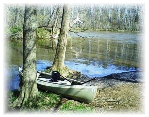
Even though the Shenandoah River is generally a "quiet" river, this trip was taken in April and during high water. Our intent was to fish (this being the first outing of the year to wet a line) but the water was way too fast and it ended up just being a fast moving trip that was still enjoyable.
We started at the low water bridge near Bentonville (mile marker 28)...we normally park on the west side of the river where there is a parking area, but the bridge had water (and logs) flowing over it and we ended up parking at the east side of the river. The take out point that we used is at mile marker 44 at Luray Avenue in Front Royal (near the pump station). You can't miss it...less than a mile after you pass under the Rte. 619 bridge, it's on river right.
 The trip is approximately 16 miles and normally takes 6 or 7 hours (when fishing)...it's a full day out there when you are taking your time to fish. The fishing for smallmouth bass is excellent with a few other species thrown in.
There is a lot of flat water with the occasional Class II riffle and ledge along the way. When the water is low, you WILL scrape bottom in a few areas. When the water is moving (as this trip was) it can get a bit sporting in the normally Class II rapids which either get washed out or become almost a Class III adventure.
There are also a lot of places along the way to stop and have your lunch.
Accommodations:
At the low water bridge, there is ample parking on the west side of the river.
Fees:
No fees, but a Virginia fishing license is required to fish.
Directions:
The take-out is just out of Front Royal...take Royal Avenue before it turns into U.S. Route 340. You'll see signs for "Skyline Drive"...on the right you will take a right on Luray Avenue. If you miss it, you can then take a right on Criser Road and that will get you back to Luray Avenue. Take Luray Avenue all the way down to the river and there are a few parking spaces to leave your vehicle at the take out-point.
To get to the put-in, you travel south out of Front Royal on U.S. Route 340 for approximately 10 miles until you get to the little town of Bentonville (obey the speed limit). You'll see a little white church on your right...immediately take a right after it onto Route 613 (Indian Hollow Road). This will take you down to the river...very windy, so be careful. Cross over the low water bridge and park immediately on your right in a public launch-parking area.
Trip Details
- Sport/Activity: Kayaking, Canoeing
- Skill Level: Advanced
- Water Type: River/Creek (Up to Class II)