
Pequabuck River in Connecticut
Trip Overview
 I followed the earlier posted report on this river (refer to it for driving directions). I went solo in a canoe and the river is probably better suited to canoes.
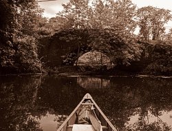
On this trip, the river had a 2 to 1 current - 2 hours up, one hour back down. The river meanders tightly through forests and wetland meadows, set down most often in 3 foot high cut banks. I did not see any building until I was two hours upstream and I saw no one after leaving the put-in. The bottom is sandy and usually 2 feet or more in depth.
It took 1 hour to reach the riffles below Route 6. I waded and pulled the canoe 50 yards up the inside of the bend in shin-deep water and found that the river pooled just below the bridge. There is a strainer on the outside of this bend, so use some caution. The gravel bar here could also be portaged into the pool, easily.
 The current was a bit faster above Route 6 and the river narrowed more. There was also more downed timber in the water, but nothing too difficult to maneuver around and nothing that I saw as particularly hazardous.
I continued another hour upstream from Route 6 where I found both the right and left forks to have bank to bank downed trees. In both cases, they could be clambered over or around... I saved that for a later trip.
I was out for just about 3 hours and thought it to be an excellent short trip.
Here's a link to my blog report, with photos:
canoepost.blogspot.com/2013/06/exploring-pequabuck.html
Directions:
Meadow Road, just west of Route 10. It was easy to find.See previous posting for more info.
Trip Details
- Skill Level: Beginner
- Water Type: River/Creek (Up to Class II)