
Napa River, Cuttings Wharf in California
Trip Overview
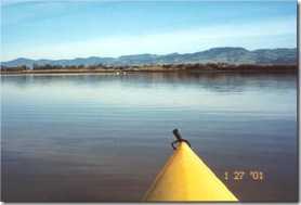 I launched at the Cuttings Wharf, which is approximately 28 miles from my home in Benicia, California. While coming back from the Brazos RR crossing bridge I took the first right turn thinking it was the entrance to the waterway around Bull Island. This waterway flowed in a direction that seemed to coincide with the map in my head of Bull Island but it was Fagan Slough. And, as I went south and then east and then north, the water was getting shallower and narrower and, well, duh, it was coming to an end! Anyway, I turned around and got back just fine to the main river and even stopped at an isolated beach on the west side of the Fagan Slough. Then I paddled up river some more and found the true opening to Bull Island. But it was getting late so, I have put off another attempt at the Bull for another day.
There is something mysterious about this area of the Napa River.
I went out again for a short trip on Easter Sunday and darned if I still could not find the waterways around Bull Island. The map is so clearly marked. I first went up river and tried to find the right turn for the norhern siden of the Island but that continued on without an apprent break. I went up as far as the Hwy 12/29 overpass and under the George W. Butler Bridge. Then, I turned around to the south and headed towards the Wharf. I went a little past the wharf and turned left into an opening I thought was the southern side of the Island but this turned into another dead end slough. (So dead end that I phototgraphed a turkey vulture there!)
Now, darn it, where is the waterway around Bull Island!!
Accommodations:
Good facilities. A nearby cafe.Directions:
Hwy 29 to 121 turnoff to Sonoma and about 1 or 2 miles to Cuttings Wharf left turn. Follow this road for about 2 miles to the end.Resources:
Not required although I did have a geological map.Trip Details
- Trip Duration: Day Trip
- Skill Level: Beginner
- Water Type: Open Water/Ocean