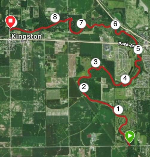
Trip Overview
Relaxing country paddle on a small river in Northern IL. We paddled with the USGS South Branch Kishwaukee River Near Fairdale (FDLI2) gauge reading 2.24 ft, 0.0735 kcfs. We think that it would need to be at least 2.5 ft to prevent quite a few low spots and needing to walk our canoe. If the flow was between 2.5 and 3 ft, it would be perfect. Nevertheless, it was a beautiful paddle on a quaint river. Tones of fish in the river with many anglers enjoying the bounty - bring a pole if that's what you do. Only an 8-minute shuttle, one way, between the two launches - really ideal. With a bit of walking the canoe, a very leisurely pace (2.4 mph average), and low flow on the river, it took us 3 hrs and 45 min.
Safety Notes
There are some concrete bank reinforcements and older metal fenceposts in the river. They do not pose any real risk, but good to be aware of.
Conditions
USGS South Branch Kishwaukee River Near Fairdale (FDLI2) gauge reading 2.24 ft, 0.0735 kcfs
Portage Notes
No portages but we did walk the river in 10ish spots due to low flow. There was one strainer possibility, but we were able to pass due to low flow. If there was more flow, you'd have to do a very short portage to be safe.
Trip Details
-
Trip Dates:
8/8/2020
-
Sport/Activity:
Kayaking, Canoeing
-
Skill Level:
Beginner, Intermediate
-
Water Type:
Flat/Sheltered Water, River/Creek (Up to Class II)