A self-supported trip created by
guest-paddler
Trip Overview

About 8 miles of the Elk River to an unnamed access point on Elkhurst Road.
USGS Streamflow gauge at Queen Shoals was 4.75 and dropping.
Equipment - Old Town Discovery 158, paddles, life jacket, lunch, water, and a smile.
Time - 6 hours with lunch stop and numerous stops for swimming.
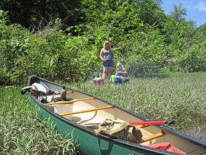
We put in under the Hartland Bridge. This access point is not easy. Once bridge construction is complete, it should be better. We paddled roughly 8 miles. Some moderately long eddies with some fast shoals that are Class I. Some fun rocker waves, but no big white water. We stopped a few miles down on one of the many small islands, built a small fire, cooked hot dogs, and ate lunch. We pulled out at an unmarked access point along Elkhurst Road about one mile below the mouth of Sycamore Creek.
We had to walk beside the canoe a few times for less than 50 yards through some shallow shoals.
This is a great trip with Elkhurst Rd. on the north side of the river through out. There are houses and camps on the river bank most of the way, but still feels fairly isolated due to vegetation. There may be cell phone coverage, but it would be very spotty at best. Next time I plan to put in about a mile above the swinging bridge (now closed) at Blue Knob Road, and paddle further down to Twistabout Creek. The faster, more fun shoals are in this section.
There are no "official" access points to the river along this section except at state bridges. There are access points that the public uses, I would suggest knocking on a door and asking before using one near a house.
Accommodations:
None
Fees:
None; however if you're fishing, a state license is required
Directions:
State Route 16 south from Clay, WV (approx. 2 miles).
Pull out point 8 miles down stream. County Route 5, Elkhurst Rd. follows river downstream to Procious.
Trip Details
-
Sport/Activity:
Canoeing
-
Skill Level:
Intermediate
-
Water Type:
River/Creek (Up to Class II)