
Egmont & Passage Keys in Florida
Trip Overview
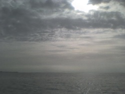
My second trip to Egmont Key from Anna Maria Island. My first trip was February 20, 2006, in a Manitou 14. This trip I took my Chatham 17. Before starting on the trip, make sure to do your Homework. I checked the tide and current charts, the weather forecast on the NWS site, and local weather stations. The later you can get weather info from the station atop the Rod & Real Pier and at Egmont Key. I tried to minimize as many weather and tidal effects as possible. I happen to paddle on a slack tide, in the middle of two flood tides, looks like a curved stair-step on a chart. The weather that day was overcast, temperature around 80-85 (cool for June!!) winds from the southeast at 5 Kts. or less, light chop.
Among my gear, I brought along a VHF radio and a total of 11 liters of water. 1 liter in an NRS hydro pack and the other 10 liters in a MSR hydro-pack. I'm just glad it was overcast!! I had the makers, Rod & Real Pier, and the pilot dock on Egmont Key as waypoints and as a route on my GPS.
I took out of Bayfront Park at 7:55 and headed towards Rod & Real Pier. From there I turned north towards Channel Marker "3QG", a lit, bell barrel buoy. However, I quickly noticed white-caps from the west in my path where Passage Key "use" to be!! The Island finally met its match and was under water. It's now a vast area of breakers. I turned NNE and advanced around the outside of the breakers.
From there, I returned to the north and located "3QG" over a mile away. Upon passing the marker, I turned northwest towards a private fish reef marker "EK", then turned west towards the pilot dock on Egmont Key. I land south of the pilot dock where the park landing area is located.
I paddled non-stop from Bayfront Park and was on Egmont Key at 8:47, distance 4.6 miles. After a break, I paddled clockwise around Egmont Key. I stayed roughly 500 to 1000 feet offshore to avoid birds, boaters, breaking waves, and the old fort at the southwest end of the island. You basically have to "thread the needle" at both the north and south end of the island to avoid breaking waves. The surf in the Gulf was around 2-3 feet, but with a long wavelength. I paddled 5.1 miles in an hour to go around Egmont Key. Upon rounding the island, I landed again south of the pilot dock and took a break before heading on my return trip to Bayfront Park. I took a reciprocal course back to Bayfront Park. I landed back at Bayfront Park at 11:32. My total trip distance was 14.2 miles, average speed was 5.2 mph.
A couple of thoughts on this trip:
I did this trip alone. Make sure you let someone know where you are going!! Carry a VHF radio. Carry flares and other safety gear. Carry twice as much water as you usually use on a trip, if not more!! I was lucky it was overcast, and I still consumed roughly 9 liters of water!! Take some food to eat, make sure to bring back your trash. Do not attempt this if you haven't been in rough water or dealt with currents. This trip is of the hardest on the west coast of Florida -- it rates right up there with hiking the Grand Canyon or climbing a peak. Those who do it though, have completed a momentous trip!!
Accommodations:
Bayfront has restrooms, a shower, and water. There are many restaurants, vacation rentals, and motels on Anna Maria Island.
Fees:
No fee, just as long as you are not parked overnight at Bayfront Park
Directions:
I took out of Bayfront Park at the north tip of Anna Maria Island. Not to far from the Rod & Real Pier.
Resources:
Charts US 11415 and 11425
Trip Details
- Trip Duration: Day Trip
- Sport/Activity: Kayaking, Canoeing
- Skill Level: Advanced
- Water Type: Open Water/Ocean