
Pictured Rocks National Lakeshore in Michigan
Trip Overview
 Left Corpus Christi 10:10am Sunday July 14 to drive 230 miles to Austin to pick up Mark White. The two of us then drove to Grand Marais, Michigan, to attend the Great Lakes Sea Kayak Symposium from Wed 7/17 through Sunday 7/21. Arrived at Grand Marais 5:30pm Monday, just in time to select a campsite for the week at Woodland Park Campground, set up our tents, and have dinner.
PICTURED ROCKS:
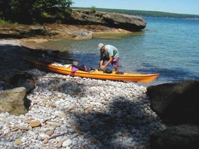
Tuesday 7/16 drove through the Pictured Rocks National Lakeshore on a gravel road from Grand Marais to Miners Beach to launch for the 18 mile paddle along the Pictured Rocks cliffs, around Grand Portal Point, Chapel Beach, and Spray Falls. The road is slow but spectacularly beautiful. For the coast paddle, had great weather: sunny and warm�even the water. Nice launch site at Miners Beach, although there is a long portage of kayak and supplies from the parking lot to the beach. Paddle north along the cliffs was spectacular. Wish I could have taped the sounds of the birds, surf, waves, and thundering of waves inside the caves. Were only a few kayakers out enjoying the spectacular sights, but lots of tour boats filled with tourists. Chapel Beach provided a nice lunch spot and swim area. Spray falls were spectacular, very cold.
GRAND ISLAND:
 The rest of the week was spent in varied Symposium activities. The Symposium ended Sunday, and Monday we drove to Munising to launch from their tourist park for a two day paddle around Grand Island. Only $2 for each paddler to leave the car there and launch the kayaks, and camping was free on Grand Island. It was less than a mile to Grand Island's Murray Bay, and we spent some time looking at an old sailing schooner that sunk in the late 1800's. Wreck still very visible in the shallow clear waters. Then paddled up the east coast of the island, along beautiful painted rocks, caves, and forests. Paddled on up to the north tip of the island to land at North Beach and look at the lighthouse up there. Waves and wind were heavy out of the NW (25 mph and 3-5 foot waves) so didn't continue around the island to the west side, but returned down the west coast to Trout Bay. Camping facilities at Trout Bay were great�new and clean rest room, and private sites overlooking the water. Surfed all the way into the campsite on nice large waves. Tuesday morning we were anticipating a grueling paddle against heavy wind and waves to continue the trip, but the weather calmed down nicely. This is one of the most scenic paddles I have done.
Outfitting:
Performa 16.2 ft fiberglass Sea Kayak by Mayan Seas
Explorer 17'8" fiberglass Sea Kayak by Romany
Fees:
National Park fees outlined at http://www.nps.gov/piro/index.htm
Directions:
From Duluth WI go E on Hwy 2, then E on Hwy 28 to Munising.
Resources:
Park Visitor Center has maps, brochures.
See more pictures at
http://community.webshots.com/user/johnsonkw1
Trip Details
- Trip Duration: Day Trip, 2-3 Day Trip
- Sport/Activity: Kayaking, Canoeing
- Skill Level: Advanced
- Water Type: Flat/Sheltered Water