Description
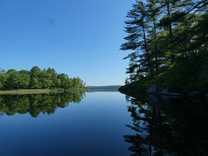
I started paddling north up the tributary and it’s a beautifully serene paddle. Loads of great blue herons and many other species of birds. It’s narrow with beautiful lily pads and wild lupine. Turned around and paddled south into the lake. The lake is largely uninhabited, about a mile in length. Was windy and a little choppy. Bald eagles soaring overhead.
You have the option of using the paved boat launch (for motorized boats) or the hand carry spot in the lawn area. It's easy enough to use and has small cement ramp and kind of sandy bottom with vegetation on either side. The lake is not huge but big enough for a half day paddle. There is a beach at the far end to land your boat and walk around to a rocky point, but swimming is not allowed (water district). Not many houses so it makes for a very nice paddle unless the wind picks up. You can also paddle up the stream for a longer outing before heading back across the lake.
Edit Description


Comments
If you have any questions about this paddling location or have other relevant information that would be helpful to other paddlers, please add them as comments below for the entire community!